Last night's pyrocumulonimbus event NE of Slave Lake (associated with SWF69 - Maria Lake wildfire) triggered numerous lightning strikes to the east of the fire - as far east as NW Saskatchewan.
As soon as the cap was breached, explosive development resulted in cloud tops to between 30-35Kft based on estimates from IR satellite imagery. 3 new wildfire detections occurred this morning in the vicinity of the greatest cluster of strikes, lending strongly to the hypothesis that they were lightning-caused.
 |
| KaBOOM |
These are impressive storms, which, like volcanic eruptions, are known to inject aerosols into the stratosphere, where they can linger for months. With a steady increase in pyroCB events according to current climate change trends, one might expect this to begin having a more substantial impact on climate over time. On the storm scale, they can generate CG lightning, strong downdrafts (due to evaporative cooling potential beneath the plume), fire whirls, and can loft burning embers well downwind of the fire, resulting in spotting and new ignitions that are very challenging to control for those engaged in firefighting activities.
An ingredients-based approach similar to one used for forecasting organized severe thunderstorms seems helpful in conceptualizing the development of this (and other) pyroCB events.
First, the large scale environment had to be supportive of both extreme fire behaviour, and the development of deep pyroconvection - and that it was. Dry, cured fuels of considerable depth, combined with hot, dry, and gusty low levels made for the potential of very hot burning fires of considerable intensity. However, this in itself is not enough to generate a pyroCB. The meteorological synoptic background environment would also have to be supportive of deep convection, and it turns out that environments favouring pyroCBs are often the same as those supporting high-based thunderstorms. It's like the "Goldilock's Principle": a deep, well-mixed boundary layer (implying hot near-surface conditions with low RH, as well as steep low level lapse rates) are necessary conditions for extreme fire behaviour, while sufficient instability aloft is also supportive of deep updrafts.
 |
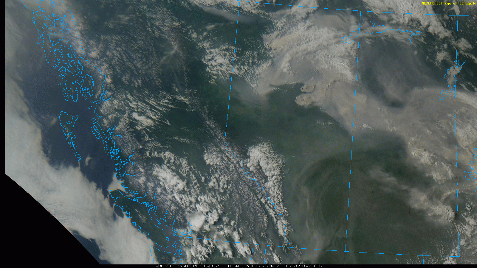
| The majority of the boreal region is suffering with extreme fire danger. |
 |
| "Inverted V" sounding, upstream at YYE just prior to initiation. Locally, would expect to see greater mid-level RH and perhaps steeper mid-level lapse rates associated with ascent. |
The 3 main ingredients for thunderstorms are moisture, instability, and lift (and shear when considering organized convection). Let's apply these here:
Moisture: This would be derived both from the combustion of fuels and attendant release of water vapour, as well as perhaps through entrainment of a layer of moist, mid-level air atop the boundary layer.
Instability: Unstable low levels owing to steep low level lapse rates would result in strong plume dynamics beneath the capping inversion, while steepening mid-level lapse rates associated with PVA from an upstream ridge-riding shortwave trough (and perhaps the proximity to the right entrance region of the upper jet) would erode capping and enable parcels below to burst into the mid and upper troposphere. It would also contribute to convective instability above a moist layer in the mid-levels.
 |
| 500mb features not well-resolved here, but thermal trough axis exists from NE BC into W NWT,. |
Lift: Lift would be generated by thermal buoyancy above the intensely-burning fire itself, amid a background environment where capping could be breached (mentioned above).
Shear: Weak speed and directional shear are needed for robust pyroCBs, unlike organized deep, moist convection such as supercells. With prog soundings showing <20kt of 0-6km shear, as well as initially insignificant low level shear, this criteria was also met.
Observations: Water vapour imagery clearly showed an area of mid-level ascent associated with a shortwave trough sinking southeastward. As soon as this ascent overspread the vicinity of the fire, capping eroded and the smoke plume squirted toward the tropopause. This occurred around 8PM MDT, and lightning flashes were detected almost immediately after. As the pyroCB plume was advected eastward, it would generate over 50 lightning flashes spanning from the near-east side of the fire into NW Saskatchewan.
 |
| Notice the cap break as mid-level ascent overspreads the fire. Also, plume is "snipped off" shortly after cold FROPA. |
 |
| Numerous flashes generally trending from earlier in the west, to later in the east, as pyroCB plume advects eastward. |
The same upper disturbance would support a surface low in NE Alberta that would track SE and bring a trailing cold front southward in its wake. Generation of the pyroCB abruptly ended near 1130PM MDT, and I can think of 2 main reasons for this. First, as the sun sets, the boundary layer decouples as the nocturnal inversion begins to develop- eventually barring further surface-based convection (especially without robust updraft dynamics aloft). But this seems to be a more gradual process. So perhaps the main reason was the establishment of a frontal inversion and attendant low level shear associated with the cold frontal passage, that snipped off the vertical development of the plume.
 |
| Red Earth is the nearest station to the NW. Volatile conditions exist during much of the day prior to initiation. Cold front initially appears to be diffuse. |


Your report on this event is outstanding, and is the type of investigative research my followers on Twitter are seeking !!!! Visit me on Twitter @trailmixx11 and #downhomeNEWS !!!!
ReplyDelete